What makes GroupTrack different
By Fred Kix · 29 October 2026 · overviewgroup ridingroute planningoffline maps
Most trail apps help one rider find a trail. I built GroupTrack for the whole group: planning the ride, getting everyone the same plan, and keeping every cart on the map once you leave the signal behind.
I've spent the last nine months building GroupTrack. My friends were worried about me. I pretty much became a recluse. But I was on a mission: not to build just another tool, but something that brings riders together and supports the riding community. Here's what came out of it, and what sets it apart.
One map, with every job one tap away
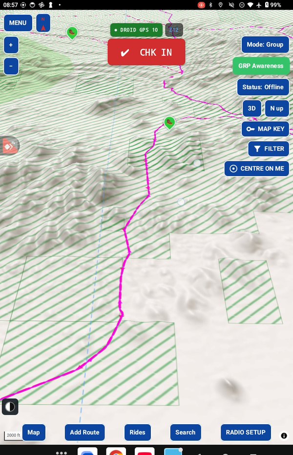
Since 2.7c, planning and riding happen on the same map, and in 2.7e it is a new vector map, sharp at every zoom and in 3D. Map, Add Route, Rides, Search and Radio Setup sit along the bottom, and every step of each job is behind its button. Nothing opens a separate app or a separate screen you have to find your way back from. And every screen has a HELP button that opens the user manual at the exact job you're doing.
It starts with the trails, and grows with every ride
The first time you open GroupTrack, you pick your home state and it loads that state's trails from every source that publishes them. That takes a few minutes once, and then every trail in your state is on your tablet with no signal needed.
What I care about most is what happens next. Published trail data misses a lot of ground. When you record a track over ground where no trail is known, GroupTrack adds it as a rider trail. You rode it, so it's rideable. Your trail network gets better every time you go out, and the route planner can use what you've ridden.
It builds the route with you
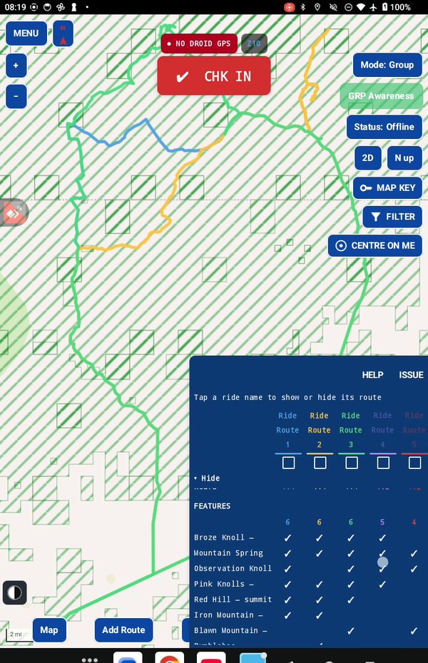
Tell GroupTrack where you'll park and how long a ride you want. If there are places you want to see, drop up to five pins on the map. It builds up to six routes and shows them side by side: the features each one passes and the miles on each trail. You keep the ones you like; they're saved under your area's name.
If a pin can't be reached from your trailhead on the trails you have, GroupTrack tells you when you drop it ("No route to this pin.") instead of quietly drawing a straight line across the desert. Prefer to draw it yourself? Build it myself snaps every point you drop to the real trail.
A ride is a package, not a link
This is the part I'm proudest of. In GroupTrack a ride holds everything a group needs: the route, the trailhead, the date and rollout time, the maps to have offline, and the radio setup. You create it once and send it by email. Each rider taps the attachment, chooses Open with GroupTrack, and the route, trailhead, maps and radio settings land on their tablet. Nobody has to rebuild your route or guess which maps to download.
Your group on everyone's map, with no cell signal
Give each cart a Meshtastic mesh radio and GroupTrack shows every cart on everyone's map, radio to radio, with no tower and no data plan. At the trailhead each rider checks in: which ride, their callsign, and their role: Leader, Rider, Middle or Tail gunner. Check-in sets the radio up for the ride.
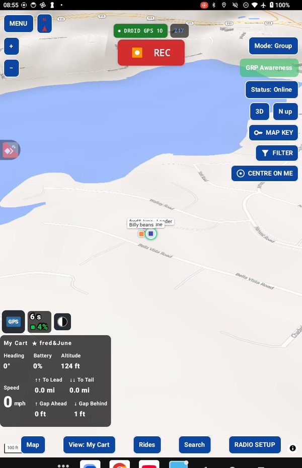
On the trail, the group view tells you how spread out you are from lead to tail, how many carts are reporting, and which have stopped. The leader's path shows on everyone's map as the lead track, so the carts behind can follow it.
Maps that are there when the signal isn't
GroupTrack downloads the maps along your route as a corridor, not a whole region. The corridor is narrow at close zoom and widens as you zoom out, so with your trail centred on the map, the way you ride, you never run off the edge of your maps at any zoom. You get every map you'll see on that ride and nothing you won't, so it downloads in a fraction of the time and takes a fraction of the storage on your tablet. The download queue keeps going if the app closes or the tablet restarts. Before you leave, tap Status: Online to switch to Offline and look over the ride area: what you see is what you'll have out there.
What it doesn't ask of you
GroupTrack is free. There's no account, no subscription and no ads, and your rides stay on your device. You don't need a radio to use it: on your own, Android only mode uses the tablet's GPS and records your track. The radio only comes in when you ride as a group.
What's coming in this series
Every three days I'll take one of these features apart in its own article: how the route planner works without any help, comparing routes, routes with pins, the ride package, opening a ride, turning a track into a ride, offline maps, group riding over mesh radio, trails, the map key and filter, and the words GroupTrack uses.
What's next
An iPad version is coming, and so is a community page where you can post public rides and sign up for them. I can't say more right now, but I'm getting there.
Take it for a test drive
Download GroupTrack, load your state's trails, and look around the places you ride. Try planning a route.
If it isn't for you, uninstall it. There's no account to close and nothing to cancel.
Help me finish it
Find something missing, awkward or broken? Please reach out to me at support@grouptrack.org. I need your input to finish this.
More articles
Next article: Let GroupTrack build the route